 |
| Fig. 1 Map of Ottoman Empire expansion to 1683 Source Information Fig. 2 Portuguese Empire in the Atlantic to 1505 |
 |
| Fig. 3 Dutch Empire in the Atlantic from 1598 to 1900 |
 |
| Fig. 4. Range of Spanish Empire and Colonial Possessions to the 20th century. Areas in blue were jointly held as the Iberian Union from 1581-1640, during the period of Spanish hegemony over Portugal. |
The development of Atlantic slavery arose from a system of empires formed around the nation-state. The rise of the Ottoman Empire in the Eastern Mediterrranean and Western Asia after 1453 spurred the European kingdoms and states to form empires for exploration and conquest of the Atlantic. The first two national kingdoms to seek the development of an ocean based empire were the Portuguese and the Castilians, who by the early 16th century would come to be known as the Spanish Empire.
 |
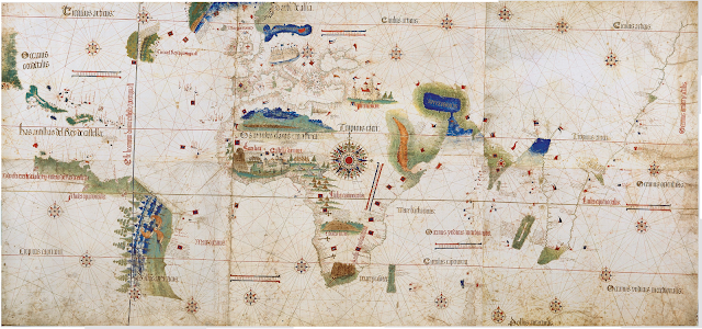
| Fig. 4 Cantino Planisphere (world map) smuggled from Portugal to Italy in 1502 Sources: Wikipedia or the fully zoomable image here at the Quebec Archives
Map Sources:
|
